 Closest Hiking Trails Near Cobalt, Idaho, United States
- World Trails
- All Trails
- Country
- United States
- State
- Idaho
- City
- Cobalt
- Can't find your trail?
- Add it to the database
-
1. Warm Springs Creek Trail
Hike to Overwhich Falls
Distance: 18.0 miles
Hamilton, Montana, United States

-
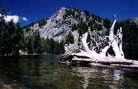
2. Big Boulder Basin, White Cloud Peaks
Incredible set of alpine lakes in a high altitude basin surrounded by 11,000' plus peaks
Distance: 12.4 miles
Clayton, Idaho, United States
-
3. Borah Peak
Hike to the summit of the tallest peak in Idaho
Distance: 7.0 miles
Challis, Idaho, United States
-
4. East Fork Trails and Anaconda-Pintler Wilderness
This is a relatively easy trail with short climbs to Starr Falls and the lake basin
Distance: 24.0 miles
Hamilton, Montana, United States
-
5. Rooster Comb Loop and Kent Lake
The trail allows a fabulous view of the Bitterroot Mountains to the west
Distance: 13.0 miles
Hamilton, Montana, United States
-
6. Monumental Trail
This trail heads north from the Bull Creek Trail to the ridge between Bull Creek and Sixteen-to-One Creek
Distance: 6.8 miles
Boise, Idaho, United States
-
7. Camas Lake Trail
The trail occasionally opens up to scenic vistas of the Bitterroot Valley and in early summer, you will see a variety of wildflowers
Distance: 6.0 miles
Hamilton, Montana, United States
-
8. Boulder Lake (optional Louie Lake)
Quick Day hike to an Alpine Lake
Distance: 4.0 miles
McCall, Idaho, United States
-
9. Silver Creek Summit Trail
At the summit views of Bull Creek and the Deadwood Ridge match any on the forest
Distance: 12.0 miles
Boise, Idaho, United States
-
10. Lightning Ridge Trail
The trail provides views of Scott Mountain, Onion Valley, Garden Valley, Crouch, and the surrounding mountains and valleys
Distance: 13.4 miles
Boise, Idaho, United States
-
11. Wet Foot Trail
The trail offers views of Wetfoot Creek and the Middle Fork
Distance: 7.2 miles
Boise, Idaho, United States
-
12. Blodgett Overlook Trail
The overlook into Blodget has a dramatic view from a scenic rock cliff, a wonderful photograph opportunity
Distance: 4.0 miles
Hamilton, Montana, United States
-
13. Rattlesnake Trail
This trail is a wonderful day hike with beautiful views of a large portion of the Middle Fork of the Payette River
Distance: 7.4 miles
Boise, Idaho, United States
-
14. Scott Mountain Trail
The trail provides views of the Big Pine Creek drainage and the South Fork of the Payette River
Distance: 6.7 miles
Boise, Idaho, United States
-
15. Alley Trail
Hike through woods and streams
Distance: 6.2 miles
Boise, Idaho, United States
-
16. One Spoon Trail
This is an ideal trail for a short day hike with unusual granite formations and wonderful views of the east side of the Middle Fork
Distance: 5.6 miles
Boise, Idaho, United States
-
17. Julie Creek trail
Distance: 6.0 miles
Lowman, Idaho, United States
-
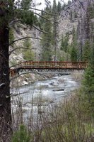
18. Crooked River Trail
Nice trail that follows the river.
Distance: 6.6 miles
Idaho City, Idaho, United States
-
19. Blue Lake Trail
Easy to Moderate hike to beautiful alpine lake.
Distance: 2.0 miles
Cascade, Idaho, United States
-
20. Poison Creek Trail
This trail provides access to Greenfield Flats, one of most unique spots on the Emmett Ranger District
Distance: 5.8 miles
Boise, Idaho, United States
-
21. Tripod Peak Trail
From Tripod Peak Lookout, there are good views of the surrounding countryside in all directions
Distance: 1.6 miles
Boise, Idaho, United States
-
22. Greenfield Flat Trail
The trail comes out onto a wide flat ridge top, where there is a 360-degree view
Distance: 10.6 miles
Boise, Idaho, United States
-
23. West Mountain Trail
The trail passes Snowbank Mountain, Jacob's Ladder, Hangman's Tree and Tripod Lookout, providing panoramic views of Round Valley, Long Valley, Smith's Ferry and Cascade
Distance: 16.1 miles
Boise, Idaho, United States