 Hungry Mother State Park Campground - Campground near Marion, Virginia, United States - Nearby
Menu
- Nearby Campgrounds
-
1. Raccoon Branch Campground
Raccoon Branch Campground is located near Sugar Grove, VA and is only 11 miles from Interstate 81 via State Route 16 Making it an easily accessed overnight for travelers. Nestled at the base of Dickey Knob, this campground offers scenic mountain views, hiking from your campsite, and cold mountain streams. Every site will accommodate RV or tent camping.
Elevation: 254 ft
Sugar Grove, Virginia, United States
11.0 miles
-
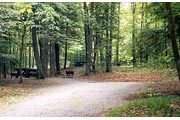
2. Hurricane Campground
Hurricane is a quiet and peaceful campground with huge trees, a creek for fishing or wading and open, grassy areas that are great for games.
Elevation: ft
Sugar Grove, Virginia, United States
11.3 miles
-
3. Old Virginia Group Horse Campground
Old Virginia Group Horse Camp is a primitive camping area located in Fairwood Valley and only minutes from the Virginia Highlands Horse Trail. If you are looking for a private place to camp with your horses while having access to a large network of horse trails in the Mount Rogers National Recreation Area, this is the spot. Groups of up to 25 people with horses will enjoy the peace and quiet of the mountains in your own private campground. Groups without horses are also welcome. This area is easily accessed from a paved state road. You will need to bring your own drinking water, tools for manure removal, and plan to use non-flush toilets. A nearby stream provides water for horses. Showers can be taken at a nearby campground for an additional fee.
Elevation: ft
Troutdale, Virginia, United States
13.2 miles
-
4. Grindstone Campground
Located in the Mount Rogers National Recreation Area. Grindstone is in Fairwood Valley, with pastures and wooded hillsides. The valley is known for outstanding trout fishing in Fox Creek. Facilities provided include restrooms, picnic tables and two impact areas. Popular activities include fishing, hiking the nature trails, horseback riding and interpretive programs. Firewood is sold at the campground. There is a local store within 5 miles of the site. Water play area and playground equipment available.
Elevation: 347 ft
Troutdale, Virginia, United States
13.6 miles
-
5. Beartree Campground
Located in the Mount Rogers National Recreation Area. Campground located in diverse vegetation. Facilities provided include restrooms and a playground. Iron Mountain Trail and surrounding trails open year-round. This area also offers a 14 acre lake for fishing or swimming. A Virginia state fishing license, trout stamp, and National Forest stamp are required. These can be purchased at local stores, but not at the campground. An annual Kids Fishing Derby is held the 3rd Saturday in May for kids ages 5-15. For more information please call 800-628-7202.
Elevation: 3400 ft
Damascus, Virginia, United States
15.3 miles
-
6. Blue Springs Gab Cabin
Located high on a mountaintop near Camp, VA, Blue Springs Gap Cabin seems to be on top of the world. Bird watching, hiking, and fishing are nearby. There are three cozy bedrooms, a kitchen and a living room with a huge fireplace. Electricity and flush toilet add comfort to this rustic mountain setting, but there is no potable water, so you must bring your own. Open from April 1 to November 30 each year.
Elevation: ft
Rural Retreat, Virginia, United States
16.6 miles
-
7. Grayson Highlands State Park Campground
Breathtaking mountain views, access to the Appalachian Trail, and facilities for horse camping make this park a great destination. Mountain streams offer superb trout fishing opportunities. The park has access to the highest point in Virginia), a part of Jefferson National Forest. Grayson Highlands State Park was originally named Mount Rogers State Park and was established in 1965. Grayson Highlands encompasses 4,822 acres. Various elevation: Entrance - 3,698 feet; Visitor Center - 4,953 feet; Little Pinnacle - 5,089 feet.
Elevation: ft
Mouth Of Wilson, Virginia, United States
17.6 miles
-
8. Dark Horse Hollow Campground
Elevation: 256 ft
Crockett, Virginia, United States
19.8 miles
-
9. Deer Trail Park Campground
Located in the heart of Southwest Virginia, Deer Trail Park & Campground offers you taste of the mountains with lots of peace and quiet. A real restful gettaway for a total retreat experience. Leave your troubles at home, come and relax with us! Bring your RV, Tent, or stay in one of our cabins! You and your pets are welcome! Come to the mountains where the mountains meet the sky! We also offer Family Picnics, Church Group Retreats, Company Parties, Family Reunions, Scout Gatherings, Birthday Parties. Data Source: http://www.deertrailpark.com/
Elevation: 226 ft
Wytheville, Virginia, United States
20.1 miles
-
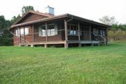
10. Stony Fork Cabin
Stony Fork is a cozy one bedroom cabin, with all the comforts of home. Go hike, mountain bike, splash in a creek, or just take the afternoon off. The Appalachian Trail, Seven Sisters Trail, and stocked streams are all nearby. Located within the Stony Fork Campground, this cabin is easily accessed from I-77 near Wytheville, VA.
Elevation: ft
Wytheville, Virginia, United States
20.8 miles
- Nearby Trails
-
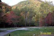
1. Hungry Mother State Park
Hungry Mother State Park in southwestern Virginia is noted for its woodlands and lake.
Distance: 6.0 miles
Marion, Virginia, United States
1.0 miles
-
2. Rowlands Creek Falls Loop
Nice loop in the Mount Rogers NRA area
Distance: 12.4 miles
Marion, Virginia, United States
10.5 miles
-
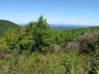
3. The Scales
Follow the Virginia Highlands Horse Trail to The Scales and enjoy sweeping vistas
Distance: 8.0 miles
Troutdale, Virginia, United States
12.9 miles
-
4. Crawfish Valley - Channel Rock Trail
Distance: 13.0 miles
Rural Retreat, Virginia, United States
13.0 miles
-
5. Mount Rogers from Elk Garden Gap
Alternate access to the highest point in Virginia
Distance: 9.0 miles
Damascus, Virginia, United States
16.7 miles
-
6. Appalchian Trail - Elk Garden to Mount Rogers to Massie Gap
Beautiful section of the Appalchian Trail though Mount Rogers National Recreational Area
Distance: 8.5 miles
Damascus, Virginia, United States
16.7 miles
-
7. Elk Garden To Brier And Cabin Ridge Loop
Loop through the Virginia Highlands Using the Virginia Highlands Horse Trail
Distance: 9.4 miles
Troutdale, Virginia, United States
16.8 miles
-
8. Mount Rogers from Grayson Highlands State Park
Hike to the highest point in Virginia
Distance: 8.0 miles
Marion, Virginia, United States
17.3 miles
-
9. Grayson Highland Park to Mount Rogers
8 mile Day Hike from Horse Trail to Mount Rogers Summit
Distance: 8.0 miles
Grayson Highland Park, Virginia, United States
17.4 miles
-

10. Grayson Highlands State Park Loop Hike
From scenic views to roaring creeks and waterfalls, this hike has it all.
Distance: 8.3 miles
Whitetop, Virginia, United States
17.4 miles