 Closest Hiking Trails Near Oriskany, Virginia, United States
- World Trails
- All Trails
- Country
- United States
- State
- Virginia
- City
- Oriskany
- Can't find your trail?
- Add it to the database
-
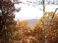
1. Price Mountain Trail
Price Mountain and upper portion of Sulphur Ridge provide good views of surrounding area, including Patterson, Bald, Richpatch and Potts Mountains
Distance: 5.5 miles
Fincastle, Virginia, United States

-
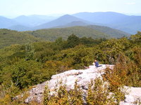
2. Potts Mountain
Beautiful vistas from the top of a ridge
Distance: 5.6 miles
New Castle, Virginia, United States
-
3. Hoop Hole Loop
Tough hike to the top of a ridge
Distance: 9.0 miles
Eagle Rock, Virginia, United States
-
4. Children's Forest Trail
The Children’s Forest trail is an all weather surface loop trail that begins and ends in the monument area of the National Children’s Forest
Distance: 0.3 miles
Covington, Virginia, United States
-
5. Roaring Run Trail
Cascading stream and scenic waterfalls
Distance: 1.5 miles
Eagle Rock, Virginia, United States
-
6. Cove Branch - Potts Arm Trail Loop
Brutal unmaintained and very isolated trail - Wonderful
Distance: 7.0 miles
New Castle, Virginia, United States
-
7. Ferrier Trail and Lick Branch Loop
Trail provides good views of Craig Creek Valley and Potts Mountain
Distance: 7.0 miles
New Castle, Virginia, United States
-
8. Andy Layne Trail
Access trail to Tinker Cliffs of the Appalachian trail
Distance: 7.0 miles
Troutville, Virginia, United States
-
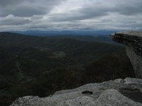
9. Tinker Cliffs
Intermediate hike up to beautiful view from a cliff side
Distance: 6.6 miles
Roanoke, Virginia, United States
-
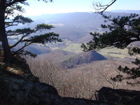
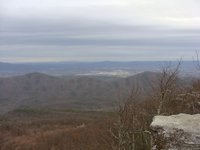
10. Hanging Rock on Potts Mtn
Short hike to westward looking overlook in Craig County
Distance: 0.7 miles
New Castle, Virginia, United States
-
11. Dry Run Trail
Great views of Big Knob and Bald Knob, two of the highest points in the Allegheny Mountains.
Distance: 9.0 miles
Covington, Virginia, United States
-
12. Fullhardt Knob
Troutville (Rt. 11) to Fullhart Knob Shelter
Distance: 7.8 miles
Troutville, Virginia, United States
-
13. Hi-Dee-Hoe
Hike to top of Brushy Mountian
Distance: 3.0 miles
Roanoke, Virginia, United States
-
14. Carvins Cove to McAfee Knob
21 Miles from Carvins Cove starting at US220 to McAfee Knob Parking Lot at VA 311
Distance: 21.0 miles
Salem, Virginia, United States
-
15. Carvin Cove / Hay Rock Overlook
Follow the Appalachian Trail to views of the Carvin Cove reservoir at the Hay Rock overlook
Distance: 8.0 miles
Roanoke, Virginia, United States
-
16. McAfee's Knob
Popular hike to a beautiful view and impressive rock formation
Distance: 7.0 miles
Roanoke, Virginia, United States
-
17. Sawtooth Ridge Overlooks
Both overlooks sit atop rock outcroppings and provide nice views of Bradshaw Valley and Fort Lewis Mtn
Distance: 2.0 miles
Catawba, Virginia, United States
-
18. Dragon's Tooth
Hike the Appalachian Trail to this famous rock outcrop.
Distance: 4.6 miles
Roanoke, Virginia, United States
-
19. North Mountain (aka The Dragon's Spine)
A strenuous ridgeline hike on an old section of the Appalachian Trail
Distance: 12.0 miles
Roanoke, Virginia, United States
-
20. Blue Suck Run Trail
Blue Suck Run Trail is a moderately difficult hike with many easy stream crossings.
Distance: 3.4 miles
Longdale, Virginia, United States
-
21. AT Trout Creek to Dragon's Tooth/Lost Spectacles Gap
Moderate AT Section from Hwy 620 at Trout Creek to Dragons' Tooth Parking Lot
Distance: 7.0 miles
Catawba, Virginia, United States
-
22. Read Mountain to Buzzard Rocks
The view from the top is one of the best in the Roanoke Valley
Distance: 3.8 miles
Roanoke, Virginia, United States
-
23. Audie Murphy Memorial
Follow the Appalachian Trail up Brush Mountain past the Audie Murphy Memorial
Distance: 7.6 miles
Catawba, Virginia, United States
-
24. Hanging Rock Battlefield Trail
The nearly two-mile path follows the route of an abandoned railroad, donated by Norfolk and Southern
Distance: 3.4 miles
Salem, Virginia, United States
-
25. Douthat State Park - Tuscarora Overlook
Long loop hike to the park's main overlook
Distance: 9.7 miles
Clifton Forge, Virginia, United States