 Closest Hiking Trails Near South Platte, Colorado, United States
- World Trails
- All Trails
- Country
- United States
- State
- Colorado
- City
- South Platte
- Can't find your trail?
- Add it to the database
-
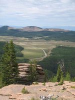
1. Devil's Head Lookout Trail
The trail ends at the last fire lookout for the Pike National Forest
Distance: 2.8 miles
Sedalia, Colorado, United States

-
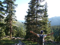
2. Gill Trail
The high trail parallels the South Platte River and provides views of the river and dramatic rock formations
Distance: 7.0 miles
Bailey, Colorado, United States
-
3. Maxwell Falls Trail
Hike to Maxwell Falls
Distance: 4.0 miles
Evergreen, Colorado, United States
-
4. Hankins Pass Trail
The trail gives the hiker a gradually rising climb up Hankins Gulch through dense forest to pleasant open meadows and aspen groves
Distance: 13.0 miles
Como, Colorado, United States
-
5. Goose Creek Trail
This trail provides access to Boreas Pass via the old Boreas Pass Wagon Road
Distance: 9.4 miles
Como, Colorado, United States
-
6. Meridian Trail
This pleasant hike leads to a saddle, which marks the boundary between Pike and Arapahoe National Forests, as well as the boundary of the Mount Evans Wilderness
Distance: 6.6 miles
Denver, Colorado, United States
-
7. Ben Tyler Trail
The trail offers spectacular views to the north and south from its high point, and the changing colors in September
Distance: 11.4 miles
Bailey, Colorado, United States
-
8. Beartracks Lake Trail
The trail takes you to Beartracks Lake, which is nestled next to a rock cliff
Distance: 9.0 miles
Evergreen, Colorado, United States
-
9. Beaver Meadows Trail
Within a mile of the trailhead, a scenic meadow takes form with beaver ponds dotting the area
Distance: 6.0 miles
Evergreen, Colorado, United States
-
10. Lizard Rock Trail
Near the top, this trail approaches a rock formation that resembles a lizard
Distance: 4.6 miles
Platte Springs, Colorado, United States
-
11. Lovell Gulch Trail
The trail offers spectacular views of Pikes Peak and Ute Pass
Distance: 5.5 miles
Woodland Park, Colorado, United States
-
12. Aspen Grove Trail
This is a short loop trail for the blind and those in wheelchairs.
Distance: 0.4 miles
Colorado Springs, Colorado, United States
-
13. Abyss Lake Trail
The trail is a popular hiking trail, which terminates at Abyss Lake
Distance: 17.6 miles
Grant, Colorado, United States
-
14. Burning Bear Trail
This pleasant trail follows Burning Bear Creek west from Geneva Creek, over a ridge, and down Lamping Creek on the west side of the ridge
Distance: 5.5 miles
Grant, Colorado, United States
-
15. Silver Dollar Lake Trail
The trail leads to two lakes that are above treeline
Distance: 3.0 miles
Georgetown, Colorado, United States
-
16. Hardrock Trail
Elevenmile Canyon is the primary attraction in the area
Distance: 1.8 miles
Lake Gorge, Colorado, United States
-
17. Gibson Lake Trail
The trail follows the Lake Fork drainage to a pretty lake nestled in a high tundra bowl
Distance: 4.8 miles
Bailey, Colorado, United States
-
18. Crags Trail
This trail leads to "The Crags", a group of rock pinnacle formations
Distance: 3.0 miles
Colorado Springs, Colorado, United States
-
19. Grays and Torreys Trail
Grays and Torreys offers hikers the opportunity to hike two fourteeners in one day
Distance: 10.0 miles
Bakerville, Colorado, United States
-
20. Bard Creek Trail
Following the mountain ridge north of Georgetown, views of the town as well as the Continental Divide are numerous
Distance: 20.0 miles
Empire, Colorado, United States
-
21. French Pass Trail
This trail provides access to the Continental Divide
Distance: 7.6 miles
Jefferson, Colorado, United States
-
22. Horsethief Park Trail
The trail culminates at an interesting rock outcropping known as "Pancake Rocks"
Distance: 8.0 miles
Woodland Park, Colorado, United States
-
23. Jefferson Lake Trail
This trail circles Jefferson Lake and provides access for fishing
Distance: 1.5 miles
Jefferson, Colorado, United States
-
24. Bakerville / Loveland Trail
The sound of Clear Creek flowing along the trail drowns out the zooming of vehicles and the trees along the creek bank obstruct the view of civilization.
Distance: 9.0 miles
Bakerville, Colorado, United States
-
25. James Peak Lake Trail
Hike to a lake
Distance: 2.2 miles
Rollinsville, Colorado, United States