 Closest Hiking Trails Near Piney River, Virginia, United States
- World Trails
- All Trails
- Country
- United States
- State
- Virginia
- City
- Piney River
- Can't find your trail?
- Add it to the database
-
1. Virginia Blue Ridge Railway Trail
This trail is idyllically located in the rolling Virginia countryside and follows the banks of the Piney and Tye Rivers
Distance: 8.0 miles
Piney River, Virginia, United States

-
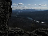
2. The Priest to Crabtree Falls
Hike the toughest part of the Appalachian Trail and descend next to a large cascading waterfall
Distance: 8.6 miles
Montebello, Virginia, United States
-
3. The Priest
Hike the toughest part of the Appalachian Trail
Distance: 8.0 miles
Montebello, Virginia, United States
-
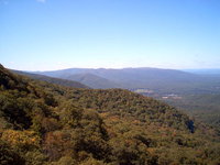
4. Mount Pleasant
Relaxing hike to the summit with two rock outcrops offering beautiful views
Distance: 6.0 miles
Buena Vista, Virginia, United States
-
5. Cold Mountain Loop
Cold Mountain is a bald affording nice, open views
Distance: 5.7 miles
Buena Vista, Virginia, United States
-
6. Crabtree Falls Trail
Hike to the top of the waterfall
Distance: 4.4 miles
Montebello, Virginia, United States
-
7. Spy Rock To Crabtree Falls
Enjoy 360 degree views from Spy Rock and continue to a large waterfall.
Distance: 8.4 miles
Montebello, Virginia, United States
-
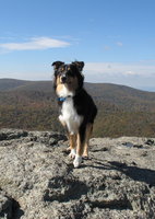
8. Spy Rock
Enjoy spectacular 360 degree views from the summit
Distance: 3.2 miles
Montebello, Virginia, United States
-
9. White Rock Falls
Hike to a 35 foot waterfall
Distance: 5.0 miles
Waynesboro, Virginia, United States
-
10. James River State Park
The park has three miles of river frontage, 1,500 acres of rolling farm meadows, three fishing ponds, beautiful vistas, 15 miles of hiking trails and quiet forests
Distance: 15.0 miles
Lynchburg, Virginia, United States
-
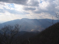
11. Three Ridges Wilderness / Hanging Rock Overlook
Hike the Appalachian Trail to a scenic 180 degree view
Distance: 8.0 miles
Staunton, Virginia, United States
-
12. Saint Mary's River Waterfall From Blue Ridge Parkway
Saint Mary's Wilderness River Waterfall from the Blue Ridge Parkway
Distance: 10.0 miles
Raphine, Virginia, United States
-
13. Whetstone Ridge Trail
Long ridge walk with many views.
Distance: 11.9 miles
Buena Vista, Virginia, United States
-
14. Saint Mary's Wilderness - Saint Mary's River Waterfall
River hike to Saint Mary's River Waterfall
Distance: 4.6 miles
Raphine, Virginia, United States
-
15. Bluff Mountain
Short and steep hike along the Appalachian Trail to a nice view.
Distance: 4.0 miles
Amherst, Virginia, United States
-
16. Humpback Rocks
Hike to a famous rock outcrop offering beautiful mountain views
Distance: 2.0 miles
Waynesboro, Virginia, United States
-
17. Otter Creek Trail
Parallels the Blue Ridge Parkway from Otter Campground to the James River Visitor Center
Distance: 3.5 miles
Glasgow, Virginia, United States
-
18. Otter Lake Loop Trail
Provides scenic views of Otter Lake
Distance: 0.9 miles
Glasgow, Virginia, United States
-
19. Little and Big Rocky Row Hike
This streneous hike takes you to the summit of Big Rocky Row with views into the James River Valley
Distance: 8.0 miles
Glasgow, Virginia, United States
-
20. Big Rocky Row Loop
AT to Big Rocky and returning on Saddle Gap trail
Distance: 9.3 miles
Glasgow, Virginia, United States
-
21. James River Heritage Trail
This is a beautiful scenic walk or bike ride through an historical area
Distance: 5.0 miles
Lynchburg, Virginia, United States
-
22. Canal Lock Trail
Leads to the restored Battery Creek Lock on the James River
Distance: 0.4 miles
Glasgow, Virginia, United States
-
23. Trail Of Trees
The trails wanders through a shaded stream drainage
Distance: 0.4 miles
Glasgow, Virginia, United States
-
24. Little Rocky Row / Fullers Rocks
Lesser used trail, ending with the rocks that sit atop the ridge and afford an outstanding, unobstructed view north, east, and south
Distance: 6.0 miles
Glasgow, Virginia, United States
-
25. Balcony Falls Trail
Scenic views from the top of the ridge include the town of Glasgow and the James River Gorge
Distance: 8.2 miles
Glasgow, Virginia, United States