 Closest Hiking Trails Near Healing Springs, Virginia, United States
- World Trails
- All Trails
- Country
- United States
- State
- Virginia
- City
- Healing Springs
- Can't find your trail?
- Add it to the database
-
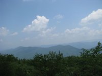
1. Douthat State Park - Tuscarora Overlook
Long loop hike to the park's main overlook
Distance: 9.7 miles
Clifton Forge, Virginia, United States

-
2. Lake Moomaw - Greenwood Point Trail
Nice hike to an overlook of the lake
Distance: 6.4 miles
Warm Springs, Virginia, United States
-
3. Back Creek Gorge Trail
Back Creek is a stocked trout stream, with several deep pools that are inviting for fishing and swimming
Distance: 1.0 miles
Warm Springs, Virginia, United States
-
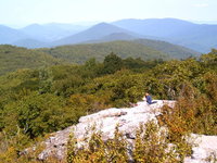
4. Beards Mountain Spur Trail
Beautiful views of the surrounding mountains.
Distance: 1.0 miles
Warm Springs, Virginia, United States
-
5. Dry Run Trail
Great views of Big Knob and Bald Knob, two of the highest points in the Allegheny Mountains.
Distance: 9.0 miles
Covington, Virginia, United States
-
6. Rich Hole Wilderness Trail
The trail offers a great opportunity to the hiker in search of solitude, wildlife, and spectacular views of the surrounding mountains and valleys
Distance: 5.5 miles
Clifton Forge, Virginia, United States
-
7. Bear Rock Trail
This trail leads you through hardwood forest and rock outcroppings to the top of Warm Springs Mountain
Distance: 1.0 miles
Warm Springs, Virginia, United States
-
8. Blue Suck Run Trail
Blue Suck Run Trail is a moderately difficult hike with many easy stream crossings.
Distance: 3.4 miles
Longdale, Virginia, United States
-
9. Cocks Comb Trail
This trail has the most spectacular viewing opportunity on the district
Distance: 0.5 miles
Longdale, Virginia, United States
-
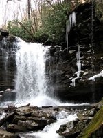
10. Roaring Run Trail
Cascading stream and scenic waterfalls
Distance: 1.5 miles
Eagle Rock, Virginia, United States
-
11. Hoop Hole Loop
Tough hike to the top of a ridge
Distance: 9.0 miles
Eagle Rock, Virginia, United States
-
12. Big And Little House Mountains
Hike to the summit of Big and Little House Mountain to enjoy beautiful views
Distance: 9.2 miles
Lexington, Virginia, United States
-

13. Land Of Goshen
Loop through Goshen Pass, Jump Rock and Viewing Rock overlooks
Distance: 8.3 miles
Lexington, Virginia, United States
-
14. Children's Forest Trail
The Children’s Forest trail is an all weather surface loop trail that begins and ends in the monument area of the National Children’s Forest
Distance: 0.3 miles
Covington, Virginia, United States
-
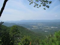
15. Potts Mountain
Beautiful vistas from the top of a ridge
Distance: 5.6 miles
New Castle, Virginia, United States
-
16. Price Mountain Trail
Price Mountain and upper portion of Sulphur Ridge provide good views of surrounding area, including Patterson, Bald, Richpatch and Potts Mountains
Distance: 5.5 miles
Fincastle, Virginia, United States
-
17. Falls of Hills Creek
A short hike to 3 waterfalls (gets better as you go)
Distance: 1.5 miles
Richwood, West Virginia, United States
-
18. Cove Branch - Potts Arm Trail Loop
Brutal unmaintained and very isolated trail - Wonderful
Distance: 7.0 miles
New Castle, Virginia, United States
-
19. Cass Scenic Railroad
Nostalgic train ride to Bald Knob
Distance: 0.1 miles
Cass, West Virginia, United States
-
20. Augusta Springs Wetland Trails
This two- thrids mile easy loop trail is fully accessible and leads you through meadows, forests and wetlands
Distance: 0.7 miles
Staunton, Virginia, United States
-
21. Balcony Falls Trail
Scenic views from the top of the ridge include the town of Glasgow and the James River Gorge
Distance: 8.2 miles
Glasgow, Virginia, United States
-
22. Cold Springs Trail
The trail passes through a diversity of terrain and several overlooks and offers excellent views of the Deerfield Valley.
Distance: 4.4 miles
Staunton, Virginia, United States
-
23. Hanging Rock on Potts Mtn
Short hike to westward looking overlook in Craig County
Distance: 0.7 miles
New Castle, Virginia, United States
-
24. McDowell Battlefield Trail
The McDowell Battlefield Trail leads to the top of Sittlington Hill and the core of the McDowell Battlefield
Distance: 1.0 miles
McDowell, Virginia, United States
-
25. Devil's Marbleyard
Loop hike around this boulder field
Distance: 8.5 miles
Natural Bridge Station, Virginia, United States