 Closest Hiking Trails Near Millboro, Virginia, United States
- World Trails
- All Trails
- Country
- United States
- State
- Virginia
- City
- Millboro
- Can't find your trail?
- Add it to the database
-
1. Beards Mountain Spur Trail
Beautiful views of the surrounding mountains.
Distance: 1.0 miles
Warm Springs, Virginia, United States

-
2. Rich Hole Wilderness Trail
The trail offers a great opportunity to the hiker in search of solitude, wildlife, and spectacular views of the surrounding mountains and valleys
Distance: 5.5 miles
Clifton Forge, Virginia, United States
-
3. Land Of Goshen
Loop through Goshen Pass, Jump Rock and Viewing Rock overlooks
Distance: 8.3 miles
Lexington, Virginia, United States
-
4. Cocks Comb Trail
This trail has the most spectacular viewing opportunity on the district
Distance: 0.5 miles
Longdale, Virginia, United States
-
5. Bear Rock Trail
This trail leads you through hardwood forest and rock outcroppings to the top of Warm Springs Mountain
Distance: 1.0 miles
Warm Springs, Virginia, United States
-
6. Douthat State Park - Tuscarora Overlook
Long loop hike to the park's main overlook
Distance: 9.7 miles
Clifton Forge, Virginia, United States
-
7. Big And Little House Mountains
Hike to the summit of Big and Little House Mountain to enjoy beautiful views
Distance: 9.2 miles
Lexington, Virginia, United States
-
8. Blue Suck Run Trail
Blue Suck Run Trail is a moderately difficult hike with many easy stream crossings.
Distance: 3.4 miles
Longdale, Virginia, United States
-
9. Back Creek Gorge Trail
Back Creek is a stocked trout stream, with several deep pools that are inviting for fishing and swimming
Distance: 1.0 miles
Warm Springs, Virginia, United States
-
10. Augusta Springs Wetland Trails
This two- thrids mile easy loop trail is fully accessible and leads you through meadows, forests and wetlands
Distance: 0.7 miles
Staunton, Virginia, United States
-
11. Cold Springs Trail
The trail passes through a diversity of terrain and several overlooks and offers excellent views of the Deerfield Valley.
Distance: 4.4 miles
Staunton, Virginia, United States
-
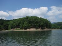
12. Lake Moomaw - Greenwood Point Trail
Nice hike to an overlook of the lake
Distance: 6.4 miles
Warm Springs, Virginia, United States
-
13. Whetstone Ridge Trail
Long ridge walk with many views.
Distance: 11.9 miles
Buena Vista, Virginia, United States
-
14. Elliot Knob
Tough hike to the highest point in the George Washington National Forest
Distance: 8.5 miles
Staunton, Virginia, United States
-
15. Dry Run Trail
Great views of Big Knob and Bald Knob, two of the highest points in the Allegheny Mountains.
Distance: 9.0 miles
Covington, Virginia, United States
-
16. North Mountain Trail
Offers hikers an opportunity for solitude and spectacular views as it winds its way along the Great North Mountain.
Distance: 14.5 miles
Staunton, Virginia, United States
-
17. Roaring Run Trail
Cascading stream and scenic waterfalls
Distance: 1.5 miles
Eagle Rock, Virginia, United States
-
18. McDowell Battlefield Trail
The McDowell Battlefield Trail leads to the top of Sittlington Hill and the core of the McDowell Battlefield
Distance: 1.0 miles
McDowell, Virginia, United States
-
19. Compton Gap to Compton Peak
Short and steep hike along the Appalachian Trail to a nice view.
Distance: 4.0 miles
Amherst, Virginia, United States
-
20. Balcony Falls Trail
Scenic views from the top of the ridge include the town of Glasgow and the James River Gorge
Distance: 8.2 miles
Glasgow, Virginia, United States
-
21. Saint Mary's Wilderness - Saint Mary's River Waterfall
River hike to Saint Mary's River Waterfall
Distance: 4.6 miles
Raphine, Virginia, United States
-
22. Shenandoah Mountain Trail
The trail is a remote, backcountry trail which winds through the ridges of the Shenandoah Mountain Range.
Distance: 23.7 miles
Staunton, Virginia, United States
-
23. Ramsey's Draft Wilderness - West Loop
Ramsey's Draft and Shenandoah Mountain Trail Loop
Distance: 16.7 miles
Staunton, Virginia, United States
-
24. Ramsey's Draft Wilderness - East Loop
Loop backpack in Ramsey's Draft Wilderness
Distance: 16.2 miles
Staunton, Virginia, United States
-
25. Cold Mountain Loop
Cold Mountain is a bald affording nice, open views
Distance: 5.7 miles
Buena Vista, Virginia, United States