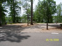
 North Bend Park Campground - Campground near Boydton, Virginia, United States - Nearby
Menu
- Nearby Campgrounds
-
1. Rudds Creek Park Campground
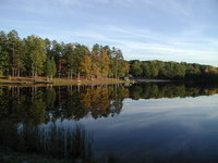
Rudds Creek Park is located at John H. Kerr Reservoir. The 50,000 acre lake extends 39 miles up the wooded, cove-studded shoreline of the Roanoke River. Whether you like to swim, fish, camp, boat, or just relax, John H. Kerr is the perfect destination to enjoy nature's beauty. The Rudds Creek Park offers 99 campsites on or near the lake. There are 75 sites with water and electric hookups and 24 primitive sites. The campground also has 9 double sites. Amenities include an amphitheater, playgrounds, swim beaches, and 2 boat launch areas. Gas and groceries are less than 2 minutes away. Visitor Assistance Center - (434) 738-6143
Elevation: ft
Boydton, Virginia, United States
7.9 miles
-
2. Occoneechee State Park Campground
Occoneechee State Park is on Virginia's largest lake, Buggs Island Lake, also known as John H. Kerr Reservoir. The park features 3.1 miles of walking trails which allow the guest to experience the history of the Occoneechee Indians and plantation life in the 1800s. The Commonwealth of Virginia began leasing the land for outdoor recreational use from the U.S. Army in 1944. Occoneechee State Park's land remains leased from the Army Corps of Engineers. Size: 2698 acres. Buggs Island Lake (Kerr Reservoir), 48,000 acres. The Panhandle area is 1,900 acres, and is open for hunting, hiking, biking and nature observation. Contact Occoneechee State Park for further information.
Elevation: 154 ft
Clarksville, Virginia, United States
11.3 miles
-
3. Longwood Park Campground
Longwood Park is located on John H. Kerr Reservoir. The 50,000- acre lake extends 39 miles up the Roanoke River along 800 miles of wooded, cove-studded shoreline with 70,000 acres of project lands and it's yours to enjoy whether you like to swim, fish, camp, go boating, or just relax by enjoying its scenic beauty. Longwood offers 66 campsites, 34 with electric and water hookups. Additional amenities include a swim beach, picnic area, boat launch, hot showers and flush toilets. Within a 15 minute drive to Clarksville, VA. All showerhouse buildings have hot showers and flush toilets. Visitor Assistance Center (434) 738-6143, campground phone is (434) 374-2711.
Elevation: ft
Clarksville, Virginia, United States
12.6 miles
-
4. Nutbush Bridge Campground
Elevation: 30 ft
Middleburg, North Carolina, United States
12.8 miles
-
5. Buffalo Park Campground
Buffalo Park is located on John H. Kerr Reservoir. The 50,000-acre lake extends 39 miles up the Roanoke River along 800 miles of wooded, cove-studded shoreline. With 70,000 acres of project lands, it's yours to enjoy whether you like to swim, fish, camp, go boating, or just relax by enjoying its scenic beauty. Buffalo Park offers 19 primitive campsites on lake with hot showers (outdoor), flush toilets, and an attendant is on duty. Swim beach, picnic area and boat launch are located nearby the campground. The recreation area is within a 20 minute drive to Clarksville, VA.
Elevation: ft
Boydton, Virginia, United States
17.7 miles
-
6. Staunton River State Park Campground
Staunton River State Park is one of the six original state parks that opened in June 1936. It is located on 1,597 acres along the shoreline of the John H. Kerr Reservoir (also known as Buggs Island Lake), at the convergence of the Dan and Staunton rivers. The largest lake in Virginia is only one of the park's many attractions, which include a swimming pool, camping, cabins, picnic shelters and nature trails. Size: 1,597 acres. Buggs Island Lake (Kerr Reservoir): 48,000 acres.
Elevation: ft
Scottsburg, Virginia, United States
20.7 miles
-
7. Paradise Lake Family Campground
Elevation: ft
Spout Spring, Virginia, United States
33.7 miles
-
8. Twin Lakes State Park Campground
Twin Lakes State Park, centrally located in Virginia's Piedmont region, provides visitors from all over the Commonwealth with a variety of lakefront activities in a secluded setting. Swimming, camping, fishing, canoeing and hiking are popular activities. Cedar Crest Conference Center is also located in the park and has facilities available for group meetings, family reunions and company picnics. Cedar crest cabins are reserved through the reservation center and on the Internet. Size: 476 acres; lakes 40 acres in total.
Elevation: ft
Green Bay, Virginia, United States
40.7 miles
-
9. Cattail Creek Campground
Elevation: 11 ft
Gaston, North Carolina, United States
41.4 miles
-
10. Spruce Pine Campground
Elevation: 41 ft
Bahama, North Carolina, United States
41.5 miles
- Nearby Trails
-
1. Eno River State Park - Cox Mountain Trail
3.75 mile loop around Cox Mountain
Distance: 3.8 miles
Hillsborough, North Carolina, United States
52.0 miles
-
2. Five Forks Trails
A series of easy to moderate trails in Dinwiddie County, Virginia, designed for hiking/equestrian.
Distance: 8.5 miles
Dinwiddie, Virginia, United States
54.5 miles
-
3. Umstead State Park - Sycamore Trail
The Sycamore Trail offers the park’s best glimpse into its past
Distance: 7.2 miles
Raleigh, North Carolina, United States
54.5 miles
-
4. Occoneechee Mountain Trail
Very Nice Intermediate Trail the highest point in Orange County.
Distance: 2.0 miles
Hillsborough, North Carolina, United States
57.1 miles
-
5. Appomattox State Forest - Carter Taylor Trail
Wildlife abounds in the ever-changing oak-hickory and pine forest. Deer, turkey, and even black bear make their homes in these woods.
Distance: 12.0 miles
Appomattox, Virginia, United States
61.7 miles
-
6. Petersburg Battlefield Battery Trail
Short Hike from the Petersburg Eastern Front Visitor Center
Distance: 0.5 miles
Petersburg, Virginia, United States
70.2 miles
-
7. James River Heritage Trail
This is a beautiful scenic walk or bike ride through an historical area
Distance: 5.0 miles
Lynchburg, Virginia, United States
72.4 miles
-
8. James River State Park
The park has three miles of river frontage, 1,500 acres of rolling farm meadows, three fishing ponds, beautiful vistas, 15 miles of hiking trails and quiet forests
Distance: 15.0 miles
Lynchburg, Virginia, United States
76.3 miles
-
9. Raven Rock State Park
Scenic trails invite you to journey into the park's interior
Distance: 2.0 miles
Lillington, North Carolina, United States
84.5 miles
-
10. Virginia Blue Ridge Railway Trail
This trail is idyllically located in the rolling Virginia countryside and follows the banks of the Piney and Tye Rivers
Distance: 8.0 miles
Piney River, Virginia, United States
86.5 miles